
REPORTS & DATA MONITORING
Subject: Fire Resilient Landscapes
A cooperative landowner-based organization has existed in the South Fork John Day River, to improve the watershed since the 1980’s. It started as private landowners and different Government Agencies working to improve the area and has developed into the South Fork John Day Watershed Council. The Council’s service area covers over 360 stream miles, and 550,000 acres. Ownership is mixed between the Ochoco National Forest, Malheur National Forest, Prineville BLM, ODFW Phillip W. Schneider Wildlife Area, and private lands.
In 2024, 40% of the South Fork John Day Watershed burned in “mega” fires, which are defined as over 100,000 acres in size. The Falls Fire burned the headwaters of the South Fork John Day, consuming over 140,000 acres, and the Rail Ridge Fire burned much of the remaining watershed at over 165,000 acres. These were not the only fires to affect our region. The Battle Mountain Complex burned over 183,000 acres, The Crazy Creek fire burned over 86,000 acres, along with many others. Wildfire is an issue across the entire Pacific Northwest. In Oregon alone over 1.5 million acres were burned, an area greater than the entire state of Delaware.
Wildfires cost our rural communities years of economic loss. Each year, we hear many tragic stories about wildfire tearing through our communities, destroying homes and businesses and costing people their lives. These fires are becoming more destructive due to landscape conditions, changing weather, and changing climate. Our rural communities depend on natural resources to support livelihoods. For years after the fire our communities experience the loss of jobs, loss of economic gain from recreation, and ranchers are put out of business due to the loss of forage. Fires of this magnitude cause our landscapes to transition to invasive species, which are not beneficial for water quality, wildlife habitat, or livestock production.
According to “The Economic Ripple Effect of Wildfires: An IMPLAN Analysis,” Wildfires' economic toll extends beyond immediate damage. According to the Joint Economic Committee (JEC) Democratic Majority's findings, wildfires in the United States can cost between $394 billion and $893 billion. These figures include immediate impacts such as diminished real estate values, property damage, and significant income losses.
IMPLAN's analysis highlights some of these losses in concrete terms. The direct income loss alone could reach $49.5 billion, with an additional $6.8 billion lost in timber resources. This economic downturn could result in a reduction of 466,000 jobs, $30.7 billion in labor income, a $52.2 billion decrease in GDP contribution, and a total output decline of $89.6 billion. These figures underscore the profound economic damage wildfires can inflict (July 30, 2024 by Candi Clouse and Chandler West).
Beyond the human and societal impacts, wildfires also affect the Earth’s climate. Forests in particular store large amounts of carbon. When they burn, they immediately release carbon dioxide into the atmosphere, which in turn contributes to climate change. After burning, forests also release carbon dioxide more gradually through decomposition. Landowners are being taxed for fire suppression and seeing no return. Landowner after landowner describes how they had to fight the fire and protect their homes on their own or with help from neighbors but receive little to no assistance from the agency that takes their tax money. These funds should go back to the communities from which they originate, and not be absorbed by State agencies.
These 2024 wildfires have the Council wanting to reach out to lawmakers to urge a change in the way our natural resources are being managed so that we can become more proactive rather than reactive toward natural disasters. Unlike other natural disasters, catastrophic wildfires can be prevented, and landscapes can be managed to become fire resilient, allowing fire to benefit the landscape as was naturally intended. We ask lawmakers to re-visit fire suppression policies at the State and National level and enable the natural resource community to become proactive rather than reactive, investing in our landscapes to allow natural processes to occur.
We look forward to hearing from your office and learning how we can work together to create fire resilient landscapes. Please contact, Amy Stiner, South Fork John Day Watershed Council Executive Director, 541-792-0435, astiner@outlook.com.
Sincerely,
Amy Stiner
SFJDWC Executive Director
541-792-0435
astiner@outlook.com
www.southforkjohnday.com
ANNUAL PROJECT REPORTS
At any given time, SFJDWC has a multitude of projects happening concurrently across our watershed. Annual project reports reflect the diversity of funders and partners we work with and explain the conservation efforts put into each project over its years of implementation.


UPPER SOUTH FORK BIO-ASSESSMENT
Courtesy of Michael B. Cole & Christopher Burtch of Cole Ecological, Inc.:
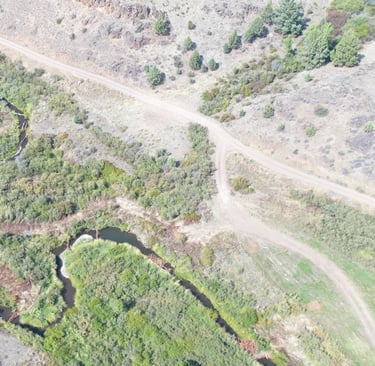
Monitoring of instream and riparian conditions in the upper South Fork John Day River occurred between the mid 1990s and mid 2000s. Until 2017, no instream assessment or monitoring work had occurred in the upper South Fork since 2006. The South Fork John Day Watershed Council implemented a Rapid Riparian Re-vegetation (R3) effort in 2017. The R3 technique is intended to re-establish natural riparian conditions by planting over 2,500 hard wood plants per acre and along both sides of four miles of river. Complimenting this project was the installation of beaver-dam analogues that are intended to slow channel incision and re-connect the floodplain in order to provide water to the riparian plantings. The objective of this restoration project was to address reasons the South Fork John Day has been listed on the 303d list: reduce stream temperature, improve the biological integrity and increase dissolved oxygen.
In the summer of 2022, a bioassessment round was performed in five reaches within the restoration project area to evaluate the effects of the R3 project to date on the ecology and habitat in the upper South Fork of the John Day River. The results of the 2022 bioassessment were compared to those from the 2001, 2004, 2006, and 2017 monitoring efforts in order to make interferences about changes since in the implementation of the R3 project.
Those results are presented here.


